2022 – Turns out it can get worse.

With the dawn of a new year (yes, we know it’s already April May June July, no we are not accepting constructive criticism at this time) the Under Over team has hit the ground running. The dream of a leisurely start back to the working week was quickly dashed with the rise of the new Court Theatre build. Kirsa assured us it would be a straightforward and easy site. Kirsa was in fact wrong. We have also been juggling many other sites, as per usual.

So, what have we all been up to? Our historians are hysterically working their magic, Clara is buried somewhere in the lab, while Jamie and Carly are sticking it out in Moncks Bay and the redzone. Nigel is in a brick barrel drain and Ashburton AND Akaroa (at the same time?!), Hamish is covered in rust, and Tristan is glued to a microscope. Our lovely lab team, Wendy and Naquita have frantically been washing shoes and torpedo bottle bases, Kirsa has been on field school (lucky) and invoicing (unlucky), and Neda, Rebecca, and Alana can be spotted in the wild somewhere in the CBD. All in all, the whole team has been putting in some major mahi these past few weeks months, and we thought we’d kick off the blog this year with some of our cool finds (It’s still technically the start of the year because we haven’t hit June July August yet, that’s our story and we’re sticking to it). We’ve summarised it down to our most dastardly sites and exciting finds for you (translation: we wrote most of this in early March… we’ve been busy).

Buckle up kids.

Court Theatre – Performing Arts Precinct

If any of you readers have been watching or reading the news recently (yes, we are famous now) you may have heard about the Court Theatre site. Additionally, if you  visited the library in January or February you may have spotted us working at the new Court Theatre site on the corner of Colombo Street and Gloucester Street. We were easy to spot given we were in full cover white asbestos suits – which are great in 30-degree heat (Rebecca here, did you know you can still get sunburnt through a full coverage suit? *Single tear smiling face*). Fun fact: asbestos itself is one of the few weaknesses of the archaeologist (along with alcohol free beer and snakes – naturally).

Figure 1. An archaeologist in the wild. If you listen carefully, you can hear them begrudging the asbestos.

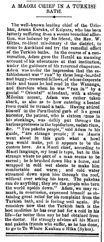
The new Court Theatre site was originally home to Cookham House, a boot factory in operation from 1851. Many other businesses were soon established on the site facing Colombo Street. These included grocers, a butcher, a jeweller, a China and glassware shop, a confectioner, photographers, solicitors, drapers, and more. Essentially, this was a major boujie shopping centre, comparable to The Crossing or Merivale (Figure 2).

Figure 2. Colombo Street looking south in the 1880s. Image: Burton Brothers Studio, c.1884c.

With it being the site of a former boot factory, we had initially joked about how we would find large pits full of shoes. Unfortunately, the joke was on us as this was literally what we found (Figure 3). Feature 1 was a very large rubbish pit with “an entire archaeological layer of compressed shoes” (any Douglas Adams fans out there?). How many shoes you ask? Two fridges full.

Figure 3. Feature 1 half sectioned with the compressed layer of archaeological shoes, some bottles, and underlying roofing slate.

In total we encountered 49 archaeological features. I too was disappointed we didn’t have one more to get to 50 but believe me 49 was plenty. We encountered all sorts of features including rubbish pits of the large, extra-large, and outrageously large variety; multiple wells and artesian bores; building remains such as foundations and pile holes; a brick cesspit; a latrine; an infilled gully; and much more. With bulk earthworks only recently finishing we haven’t completed our analysis just yet, so stay tuned for future updates. But in the meantime, here are some photos!

Figure 4. X marks the spot of yet another very large archaeological feature.

Figure 5. A brick cesspit – don’t wonder too hard about what those layers are made up of.

Figure 6. A red brick well!

Figure 7. A yellow brick well! (follow, follow, follow, follow)

Figure 8. A clay smoking pipe recovered from a rubbish pit at the Court Theatre site – we may have an upcoming blog on clay pipes so stay tuned!

Superlot 15 – Cambridge Terrace

Much like the name suggests, there were many super things about Superlot 15. The ground was super hard, it was super hot, and the archaeology was super cool. Unlike the Court Theatre rebuild, which featured a fun viewing platform shaped like a large library, you probably didn’t see us digging at Superlot 15. This is because we were hiding a metre below the surface in the one corner on the site that was filled to the brim with archaeological features. Fun fact – the metre-high edge-of-excavation was to the west, so we spent a lot of time baking in the sun! Luckily, we had Brent on site who took it upon himself to build us a sunshade made up of various bits and pieces lying around on site, which we highly appreciated. We love an innovative king. He also gave us biscuits. Is he the best digger operator ever? We think so.

Figure 9. Local archaeologists grateful for shade on hot day. Photo also featuring variations of the ‘sexy sunhat’ and ‘naughty neckshade.’ Safety first, everybody! Make sure to bring electrolytes to site on a hot day (it’s got what plants crave).

The area currently dubbed ‘Superlot 15’ is an area originally made up of parts of 6 town sections, which was used for residential purposes. The houses were owned and built primarily by Edward Coxhead Mouldey and Charles Wellington Bishop. While the Bishop family likely lived on the section until the 1890s, Edward Mouldey owned Town Sections 229-233, and we suspect he did not personally live in all 8 houses on his own. Following his bankruptcy in 1888, ownership of Town Sections 229-233 eventually passed to Alfred Bullock, who leased the 8 dwellings. Aerial imagery from the 1940s suggests the 19th century houses survived well into the 20th century!

Figure 10. Detail from Strouts’ 1877 map of Christchurch showing buildings present on the relevant town sections. Town Sections 227 and 228 (coloured blue) were owned by the Bishops until the 1890s. The project area is indicated in red. Image: Strouts, 1877.

Figure 11. Aerial image from 1946, showing buildings previously on Superlot 15. 263 Cambridge Terrace (Town Sections 227 and 228) indicated in blue. The project area is outlined in red. Image: LINZ, 1946.

We had already spent quite a bit of time on Superlot 15 since works began and had found a scattering of archaeological features across the site, but nothing too dramatic. Turns out this gem was truly saving the best (?) for last. In the space of two days, we went from 10 features to 29, and we entered what I like to call ‘Survival Mode.’ There’s nothing quite like densely packed earth to push your excavation skills to the limit. The crew at Superlot 15 were very patient with us while we desperately tried to wrap our head around these features.

Figure 12. A small portion of our small area, showing rubbish pits in the fore, mid, and background.

Figure 13. Facing the opposite direction from the previous photo, some more features. A lot of the features on this site appeared to be connected for various reasons; these rubbish pits were connected/disturbed via a 20th century drainpipe. It made for some interesting digging!

A large amount of drainage features were encountered on site – earthenware pipes, a brick sump, and a brick chamber for an artesian well. This confirmed what we had suspected all along – whoever was living here did at some point have running water and plumbing – wow! The rubbish pits on this site came in all shapes and sizes, mostly containing a lot of household refuse typical to the 19th century including a wide range of ceramics, torpedo bottles, condiment bottles, tonnes of sheep bones, piles of oyster shells, and some other fun finds. Pictured below is Rebecca holding an anchovy paste jar. You can see by her expression that she is shocked people would eat something so repugnant. Another fun find was the Cavalier smoking pipe pictured below. This site is not yet finished, so stay tuned for more hard-packed earth.

Figure 14. Rebecca gasping at the anchovy paste jar recovered at Superlot 15. Endorsed by her Majesty Queen Victoria, we however, remain sceptical of the product.

Figure 15. Local French man featured on smoking pipe.

Figure 16. A half-sectioned rubbish pit with layers. From this view we can tell the rubbish was being deposited from the west (right) side of the feature. Feet included for artistic purposes only.

Updates from The Lab

The stoneware bottle pictured below is an unusual find. It was made for a specific pub, but not a pub in Christchurch, or even New Zealand. The impression on the bottle reads “BRAY/ Six Bells/ Chelsea base: FULHAM/ STONE/ POTTERY”. This tells us the stoneware flask was made by the Fulham Pottery, which was founded by John Dwight in 1672 and primarily manufactured stoneware up until the 1950s (Oswald, et al., 1982). Six Bells was a public house located at 197 Kings Road in Chelsea, that was established by at least 1722 and is still operating today as a restaurant. Members of the Bray family are listed as the publicans from at least 1823 until at least 1866. By 1881, a Christopher J. Aston is listed in the post office directories as the manager, indicating that the Bray’s association with the pub ended sometime after 1866 and before 1881 (pubwiki, 2022).

This suggests then that the stoneware flask was made by the Fulham Pottery specifically for the Bray family and the Six Bells pub – in Chelsea. It is hard to date the flask based on the available evidence, but a manufacture date range from approximately 1823 until 1866 is assumed.

While examples have been found on other Christchurch archaeological sites of table wares that have been commissioned specifically for hotels, there have not been any examples of stoneware bottles commissioned by, or for businesses located outside of New Zealand. Searches of Heritage New Zealand’s digital library revealed that it is probable that this is the first example of this type of bottle found on a New Zealand archaeological site. Google Image searches could not find a similar bottle, suggesting that either not many of the bottles were produced, or that not many have survived and that they are rare. It is likely that the stoneware bottle was brought specifically by Mr Bowley to New Zealand. Further historical research would need to be conducted into the Bowley family to determine what their connection to Chelsea and the Six Bells pub was, but the presence of the bottle would suggest that there was some connection.

Figure 17 . The stoneware bottle manufactured for the Six Bells pub in Chelsea.

To Conclude

All in all, the team have been working really hard (as per usual) and it’s been a rather exciting start to the year. Christchurch continues to surprise us with new archaeological discoveries and while we jest about how exhausting our sites have been recently, we wouldn’t have it any other way (Rebecca here – still advocating for a three-day weekend personally). While we quietly pray for a brief reprieve from field work to tackle our reports, we do in fact thrive in the chaos. Stay tuned for future finds as rumour has it, someone has a stadium to build or something.

-Rebecca and Alana <3

Hall’s Oriental Turkish Bath

It’s very easy to think of 19th century New Zealand as being a place isolated from the rest of the world. Yet as we research and investigate colonial Christchurch, we are constantly being reminded of the connections that existed between New Zealand and the rest of the British Empire. Most often we see those connections archaeologically through artefacts, but every so often we see them in a different way. Today’s blog is on a Turkish Bathhouse we excavated at the end of last year. When I think of 19th century Christchurch, a Turkish Bathhouse is definitely not the first thing that comes to mind. Yet Turkish Bathhouses became fashionable in Britain in the 1860s and from there spread to the rest of the empire, with Turkish Bathhouses opened in New Zealand in the 1870s (Press 31/12/1874: 2).

The Turkish Bath, or Hammam, is a public bathhouse that is associated with Muslim culture and found across the Islamic world. Hammam have been in existence for over a thousand years and evolved from similar public bathhouses used by the Ancient Romans. The Hammam was both a place to get clean, and a place to socialise and conduct business. The introduction of the Hammam to the British Empire was down to one man: David Urquhart. David Urquhart was a Scottish diplomat and politician who worked in Constantinople (Istanbul) in the 1830s and travelled throughout Europe and the east over his lifetime. In 1850, Urquhart wrote a book, The Pillars of Hercules, based on his travels through Spain and Morocco in 1848. Urquhart dedicates two chapters of his book to bathhouses, describing both the history of the bathhouse and the bathhouse process.

“The operation consists of various parts: first, the seasoning of the body; second, the manipulation of the muscles; third, the peeling of the epidermis; fourth; the soaping, and the patient is then conducted to the bed of repose. These are the five acts of drama. There are three essential apartments in the building: a great hall, or mustaby, open to the outer air; a middle chamber, where the heat is moderate; the inner hall, which is properly the thermae. The first scene is acted in the middle chamber; the next three in the inner chamber, and the last in the outer hall. The time occupied is from two to four hours, and the operation is repeated once a week.”       

-Urquhart 1850: 31

To call Urquhart passionate about bathhouses would be an understatement. His chapter on the bathhouse process begins with a very Victorian description of the morality of cleanliness, followed by an extensive description of the bathhouse process. Urquhart bases his description of bathhouses on the Hammam he had visited in Turkey and is quite critical of the Moorish bath he visited on his travels, providing a comparison between the Moorish bathhouse, the Turkish bathhouse, and Roman bathhouses. Urquhart ends his chapter with a very lengthy description of the benefits of introducing bathhouses to Britain. Richard Barter, an Irish physician who established St Ann’s Hydropathic Establishment, read Urquhart’s book and collaborated with him to open Britain’s first Turkish Bath in Ireland in 1856. In 1857 a Turkish Bathhouse opened in Manchester and in 1860 another opened in London. Over the next 150 years, over 600 Turkish Baths were opened in Britain.

I visited a Turkish Bath when I was in Turkey. I didn’t take any photos, but thanks to the magic of the internet I was able to find a picture of the one I went to. It was a few years ago now, but I remember both enjoying the experience and finding it a wee bit strange being washed by a stranger. My experience started with a sauna. Following that we went to this room where we were scrubbed and washed. We then had a massage and ended with face masks. All in all, it was relatively similar to what Urquhart describes – particularly the “peeling of the epidermis” and the “soaping”. Image: Tripadvisor

In August 1884, John Charles Fisher and Duncan Beamont Wallis leased a section of land on Cashel Street and constructed a Turkish Bathhouse. Construction was completed in October 1884 and the baths were open for business by the 21st of October. While Fisher and Wallis constructed the baths, they did not operate it for long and management was taken over by W. Dation in January of 1885. Dation himself did not operate the baths for long, and by June of 1885 was advertising the sale of a large amount of the bath’s furniture and fittings (suggesting he may have had financial difficulties).

Robert Hall announced he was taking over the proprietorship of the Oriental Turkish Baths on the 1st July 1885. He described the premises at this time as being “Now in First Class Order”, having been “Fitted and Furnished in the very Best Style”, which suggests that Hall replaced much of the furniture and fittings that had been sold by Dation (Star 29/6/1885: 2). He undertook various alterations and repairs to the premises during his proprietorship, adding a third hot room that could reach 200 degrees Fahrenheit. Hall was the proprietor of the bathhouse until 1905, when the business was taken over by Messrs. Young and Co., who operated the bathhouse until the property was sold in the 1920s (Trendafilov et al. 2021).

Photograph printed in 1902, showing the street frontage of Hall’s Oriental Turkish Baths in Cashel Street. Image: Davie, 1902: 304.

An advertisement from 1886, advertising the baths. Image: Star, 27/12/1886: 2.

The construction of the bathhouse was clearly of interest to the residents of Christchurch, and a thorough description of the building was relayed in the newspapers of the time:

The building will be of brick, and will cover a ground area of 60ft by 33ft. In the front are the hair-dressing rooms. A passage runs right through the building from front to back; to the right of this from the entrance are six chambers for hot, cold, and shower baths. On the left are the rooms for the special feature of the establishment – the Turkish baths. The person wishing to enjoy the Oriental luxury will first enter one of the dressing-rooms, of which there are eight, very neatly fitted up; he then passes to the first hot room, at which the temperature is maintained at about 125 deg Fah., and having become accustomed to this, he is prepared to pass to the hotter chamber, of 150 deg on an average. Both these hot rooms are of the same size — 12ft by 9ft 6in, floored with red and white tiles, and plastered; they are heated by hot-air flues passing round them, and connected with a furnace at the back. Special attention will be paid to ventilation, not only in these rooms, but in all connected with the baths. Disc ventilators in the walls and ceiling, that can be opened or closed at will, are the description made use of for the purpose. After he has had enough of the hot-air process, the visitor will pass to the shampooing room, in which is the “needle bath.” The operation of this is to throw from a number of small jets sprays of water gradually decreasing from warm to cold, thus preventing the danger to the bather of suffering a chill after he has finished his Turkish bath. Sulphur and vapour baths are also provided in the shampooing room, on leaving which the visitor pushes aside a crimson curtain and finds himself in the “cooling room,” a large, handsomely furnished apartment, in which files of the illustrated and other papers are kept, and where one can enjoy the dolce far niente till he feels disposed to return to the dressing-room. All the rooms, except those in front, are lighted by skylights (Lyttelton Times 15/8/1884: 6).

Sadly, the original bathhouse was long gone when we excavated the site last year. However, we found a couple of features that we were able to associate with the bathhouse, which was most exciting. One was a large brick structure, found at a depth of 750 mm. The feature was a trapezoid shaped lined brick pit, 3.4 m long and 1.4 m, which was located within the footprint of the bathhouse and was interpreted as being one of the baths.

The bath feature, first exposed by the digger. The feature didn’t look like much when it was first uncovered, but careful excavation revealed something interesting. Image: A. Trendafilov.

The bath emerges. Image: A. Trendafilov.

Angel does some phenomenology and puts himself in the place of a visitor to the baths. Image: site contractor.

We suspect that the bath was constructed as part of the purpose built building and was probably sunk into the ground which has led to it surviving. Interestingly, as Angel was excavating the feature he found several bits of radiator, along with a lead pipe with evenly distributed holes along the side. The 1884 description of the new bath house mentions that there were two hot chambers available, with temperatures of 125° Fahrenheit (51° Celsius) and 150° Fahrenheit (65° Celsius), connected to a furnace at the back of the building. It is probable that the radiators were used to transfer the heat to these chambers, either through the use of steam or hot water. The small lead pipe found in the feature may have been part of the ‘needle bath’ described in the same account: “the operation of this is to throw from a number of small jets sprays of water gradually decreasing from hot to cold” (Lyttelton Times 15/8/1884: 6). It is highly likely that the evenly distributed holes, which measured six mm in diameter and were spaced at intervals of approximately 50 mm, in the pipe are those small jet sprays described in the article.

The radiators were clustered down on end of the bath. Image: A. Trendafilov.

The radiator pipes. Image: A. Trendafilov.

The lead pipe with evenly spaced holes. Image: J. Garland.

We also found several coffee and chicory bottles in the feature, and overall coffee and chicory bottles made up 13% of the total glass assemblage (normally they might make up around 1% of a total glass assemblage). The ‘Oriental Turkish Bath House’ served tea and coffee to customers, with an article from September 1884 stating that “the room in which, what is, perhaps, the most pleasant part of the process takes place is a large, handsomely furnished apartment, with Brussels carpet on the floor and luxurious couches and chairs around the walls…and small tables disposed in various parts of the room can be used either as card tables or to bear the cup of tea or coffee presented to the visitor” (Star 21/10/1884: 3). It is however surprising that they may have been serving coffee and chicory or coffee extract, both of which can be considered substitutes for ground coffee or the equivalent of ‘instant’ coffee. Their use in the 19th century is often associated with economic hardship and coffee shortages, particularly in Napoleonic France and Civil War era North America (Smith 1996; Smith 2014). It may be that the Turkish Bath House was using coffee substitutes as a matter of taste preference, but it may also have been that they were economical in what they were serving to visitors.

One of the coffee and chicory bottles found in the feature. The bottle was embossed with the mark of Thomas Symington and Co., an Edinburgh based beverage manufacturer. Symington’s Coffee and Chicory, a blended coffee beverage, is relatively common on archaeological sites in New Zealand dating from the 1880s onwards. Image J. Garland.

We also found this Cyprus patterned ewer, which was likely used in the bathhouse. The ewer was made by Thomas G. Booth, a Staffordshire potter who operated the Church Bank Pottery in Tunstall between 1876 and 1883 (Godden 1991: 86). The date of manufacture for this vessel pre-dates the construction of the Turkish Baths, but ceramic vessels during the 19th century often had uselives of up to 15-20 years (Adams 2003), which would overlap with the construction and use of the Turkish Baths. It may be that the name of the pattern decorating this vessel, the Cyprus Pattern, was a deliberate choice on the part of the owners of the baths, as a nod to the geographical location of Cyprus, south of Turkey in the Mediterranean Sea, but it may also have been a coincidence in which the visual appearance of the pattern determined the choice of its use in the Turkish Baths. Image: J. Garland.

Hall’s Oriental Turkish Bath provides a fascinating insight into the cultural melting pot of the British Empire. It’s interesting to see the introduction of Turkish Baths into Britain in the 1850s, and from there, as they became fashionable, spreading through the Empire to reach New Zealand in the 1870s. A Turkish Bath was opened in Dunedin in 1874 (Press 31/12/1874: 2), one in Auckland by 1877 (New Zealand Herald 14/07/1877: 4) while an earlier bath opened on High Street in Christchurch in 1878 (Press 22/02/1878: 1). The collision of different cultures that resulted in the spread of ideas and practices across the empire is perhaps best illustrated in the below article.

A collision of culture. Image: Evening Post 12/07/1879: 3. 

Clara Watson, Jessie Garland, Lydia Mearns

References

Davie, Mort., 1902. Tourists’ Guide to Canterbury. P. A. Herman. Christchurch Press Company Limited.

Godden, G., 1991. Encyclopaedia of British Pottery and Porcelain Marks. Crown Publishers, New York.

Lyttelton Times, 1851-1914. [online] Available at: https://paperspast.natlib.govt.nz/.

New Zealand Herald, 1863-1945. [online] Available at: https://paperspast.natlib.govt.nz/

Press, 1861-1945. [online] Available at: https://paperspast.natlib.govt.nz/

Smith, S. D., 1996. “Accounting for Taste: British Coffee Consumption in Historical Perspective”, The Journal of Interdisciplinary History, Vol. 27: 2, pp. 183-214.

Smith, A. K., 2014. “The History of the Coffee Chicory Mix That New Orleans Made It’s Own”, Smithsonian Magazine. [online] Available at https://www.smithsonianmag.com/arts-culture/chicory-coffee-mix-new-orleans-made-own-comes-180949950/ [Accessed March 2021].

Star, 1868-1920. [online] Available at: https://paperspast.natlib.govt.nz/.

Trendafilov, A., Mearns, L., Garland, J. 212 Cashel Street, Christchurch (Superlot 6c): Final report for archaeological investigations under HNZPT authority 2020/811eq. Unpublished report for Fletcher Residential Living.

Urquhart, D. 1850. The Pillars of Hercules. Harper and Brothers, New York.  

Putting The Pieces Together

Today on the blog we are discussing my favourite site of 2019. We already talked about part of the site’s history last fortnight on the blog- that it contained the store and offices for Walton, Warner and Co. and their later businesses. Today we’ll go a bit more in depth on both the history and the archaeology of the site (so if you haven’t read last fortnight’s blog then I recommend you do before reading this, otherwise this won’t make as much sense). But first, let me explain why it was my favourite site. This site was a perfect combination of a very complicated site history, super complicated archaeological features and excavations, and a very large artefact assemblage that contained a lot of unusual artefacts. Which meant it was very confusing to try and work out what was going on, but it was very satisfying when I did. This site is really complicated, so this isn’t going to be a short blog post (double the length of our normal blogs), but it’s a great way of sharing how, as archaeologists, we draw together multiple lines of evidence to work out what was happening in the past.

The History of the Site

The section of the site we’re going to be focusing on consisted of two town sections, TS 853 and TS 855. They’re highlighted in red on this 1850 map of Christchurch (ignore 857 and 858 as we’re not going to talk about them). Also shown on this map, in blue, is a creek bed. Large natural streams transversed swampy Christchurch and acted as tributaries and overflow channels for the Avon. Remember that there was a creek running through the site- it’s going to be important later on. Image: Jollie 1850 Plot of Christchurch.

Here’s the site in 1877. Those black shapes on the map represent buildings. No buildings were present on the site in the Fooks 1862 map, indicating all these buildings were constructed between 1862 and 1877. If you’ve read last fortnight’s blog, then you’ll remember that the front building on the TS 855/853 border was Walton, Warner and Co.’s store and the centre building on TS 855 was their office and that these buildings were built in 1864. The other building at the front of TS 855 also likely belonged to them, whilst the back building was a house. The buildings on TS 853 were offices that were occupied by a variety of businesses, including architects, accountants, solicitors and insurance brokers. Image: Strouts 1877.

This map, based on the recorded leases in the Deeds indexes from 1860-1872, gives some indication of how complex the history for this site was and how many different businesses were run out of the buildings on the site. We’re going to be focusing on Walton, Warner and Co., but it’s important to know that there were other businesses operating on the site. Image: A. Gibson.

And if you thought the above map was complicated, then check this one out. This is a 1909 plan, with this buildings on the site outlined in red (the blue lines are the property boundaries and the yellow shading is just our excavation are). Comparing it to the 1877 map, we can see that many of the building shown on the 1877 map were still standing in 1909, and that they are described as old and made of wood. What’s most important in this map is that is shows an old wooden building at the back of TS 853, that wasn’t there in the 1877 map, but is described as old suggesting it was probably constructed just after the 1877 map was made. Image: LINZ 1909.

So, to summarise, we’re interested in two town sections: TS 853 and TS 855. These town sections originally had a creek running through them and had buildings constructed on them after 1862, with more buildings added over the course of the 19th century. One of the occupants was Walton, Warner and Co. (later known as Wood, Shand and Co.,  who were general merchants and importers if you didn’t go back and read last fortnight’s blog). The other occupants were architects, insurance brokers, accountants and other businesses that had offices on the site.

The Archaeology

We found 19 different archaeological features during the excavation of the site. This site plan shows that most of the features were clustered at the back of the site. We’re not going to talk about every single feature from the site, but I’ve included t just to give an overview of where most of the archaeology was encountered. Image: M. Healey.

But before we go into more depth with the archaeology, there’s one more thing we need to mention. Before the archaeologist got to site, a large trench was excavated through the site (shown on the left). This trench disturbed archaeological features from the site and is easily comparable to the giant trench Heinrich Schliemann dug through the archaeological site Troy (shown on the right). Image, left: A. Trendafilov, right: C. Watson.

We’re going to break down the features we’re going to talk about into three groups. The first group consists of four features that were brick gully traps. These gully traps were located at the boundary of TS 855 and TS 853 and roughly corresponded to form a rectangle. They were also all found at a depth of approximately 200 mm below the modern surface Image: C. Watson.

One of the gully traps, exposed during excavation. This one also had earthenware pipes connecting into it. These gully traps included bricks manufactured by John Brightling between ca. 1880 and 1898, William Neighbours between 1868 and 1886 and Henry Kirk between 1885 and 1898. Image: A. Trendafilov.

The second group of features are a little more complicated. They consist of a series of deposits found running north to south along TS 853. These were deposits of artefacts in what we think was a tributary stream to the large creek shown on the 1850 map. Image: C. Watson.

This is Feature 3. It was found at a depth of 200 mm and extended down to a depth of 1400 mm and as we can see from this photo, was truncated by the unmonitored trench that was dug through the site. This photo is looking north and shows that the feature had a sloping base and consisted of several deposits. Image: A. Trendafilov.

Looking at the above photo and map, you’ve hopefully worked out that if Feature 3 was truncated by the trench then Feature 2 was located within the trench. We’ve got no idea how much of Feature 2 had been disturbed before we got to site, but we found it at a depth of 1200 mm and it extended down to a depth of 1900 mm. Also disturbed by the trench was Feature 4, which similar to Feature 3, had been truncated by the trench. What this means, is that Feature 2, 3 and 4 may all have been individual deposits within one larger deposit, but because the trench went through the middle of it, we’ll never know for sure. Image: A. Trendafilov.

And now we have Feature 5. Feature 5 was divided into six separate sub-features (told you this site was complicated). One of those, Feature 5d, was the brick gulley trap shown above. Another was a deposit of bricks that were possibly from a destroyed gully trap, as they also contained William Neighbours bricks. Two of the deposits contained 20th century material, and were found at the top of the feature, whilst the others found at a deeper depth contained 19th century material. And finally, there was Feature 15, which was a deposit of artefacts within a large metal bucket, that was found underneath Feature 5d, the brick gully trap. Image: A. Trendafilov.

Getting confused? Here’s a diagram to summarise. Essentially, we found different deposits of artefacts ranging from Feature 3 in the north to Features 5A and B in the south. These deposits extended to a depth of 1.2 m to 1.9 m (in the case of Feature 2). Feature 5D was the brick gully trap and Features 5E and 5F both contained 20th century material. Image: A. Trendafilov.

And finally, we have these features, which were located just west of the Feature 2-5 complex. These features were all rubbish pits or other types of deposits that contained artefacts dating to the 19th century. I’m not going to go into too much detail about them, as they’re a lot simpler to understand than the other features on the site, but just remember where they’re located. Image: C. Watson.

An example of what the other features looked like. This is Feature 13, a large rubbish pit that was dug into the ground. The pit is clearly able to be distinguished from the natural sandy clay that it was dug into. Image: A. Trendafilov.

The Artefacts

I’m not going to go into that much detail about the artefacts here, as that would be a whole blog post in itself (immediately starts drafting a post on them for next fortnight). Instead I’ll just make a few points.

  • A large artefact assemblage was recovered during the excavation, over 2000 artefacts in total.
  • Some of the artefact deposits clearly related to commercial activity. These included artefacts like the large deposit of identical clay pipes (pictured in last fortnight’s blog) that were found in Feature 16.
  • Some of the artefacts seemed to be related to domestic activity. These included things like food waste and worn shoes.
  • Ceramic artefacts found in the Feature 2-5 complex were highly fragmented, and sherds from one vessel were found spread across multiple features within the complex.
  • With the exception of the brick gullies and the 20th century sub-features from Feature 5, the artefact manufacture dates ranged from the 1850s through to the 1870s, with most of the artefacts likely manufactured before 1880.

A few of the many artefacts found at the site. To give you an idea of how many of the ceramic artefacts from different features conjoined, the fragments from the ceramic plate in the bottom right corner of this image were found spread across four different features in the Feature 2-5 complex. Image: C. Watson.

Bringing everything together

Now comes the fun part of archaeology (or at least I think that it’s the fun part). We consider the archaeological features we uncovered, the artefacts they contained, and the history of the site, to try and determine which site occupant likely deposited the artefacts, and from there, when and why they threw things away.

Let’s start with the ‘who’. In the case of this site, if we look at the occupants then we can see that Walton, Warner and Co. (or later iterations of the business) are most likely responsible for depositing most of the material. This is because the other occupants of the site, the insurance, accountant, architect etc offices that we haven’t really talked much about, were unlikely to be generating large volumes of rubbish, and certainly not rubbish that was obviously related to commercial practices such as the large deposit of identical clay pipes. When we compared the artefacts to those found during the excavation of Walton, Warner and Co.’s warehouses on Oxford Terrace, we found identical objects, such as the seltzer water bottles and blue dyed-body ware chambersticks (shown in last fortnight’s blog), confirming to us that the artefacts we had found were likely related to the commercial business of Walton, Warner and Co. But, (there’s always a ‘but’ in archaeology), we also found some artefacts that didn’t quite fit. These included large deposits of leather off-cuts in Feature 3 (you can see a pile of them in the artefacts photo) and lots of faunal remains. The leather off-cuts clearly looked to be from a cobbler, but there was no evidence for a cobbler occupying the site. This suggests then that some of the artefacts may have been disposed on the site from non-occupants. The leather off-cuts were clearly clustered together, meaning this may have been a one-off event, but it means we can’t say for sure that every single artefact found on the site related to Walton, Warner and Co. The faunal material is more typical of a domestic assemblage, relating to the disposal of daily food waste. There was a house located at the rear of TS 855 (you can see it in the 1877 map), so it may be that they were throwing their food away into pits shared with Walton, Warner and Co. Unfortunately, the house appears to have been leased and given how complicated the history of the site was, we’re not too sure exactly who was living in it.

Now let’s go to the ‘when’. From the artefacts, we know that most of the features contained material dating between 1850 and the late 1870s, with the exception of the brick gully traps that dated to the 1880s, and some of the deposits in the top of Feature 5 that dated to the 20th century. Those 20th century deposits contained plastic, indicating that they dated to the mid-late 20th century and despite being in the stream complex, weren’t connected to it. But we don’t have to just go off the artefacts to work out when features were deposited. We can also use information from the historical record, like maps.

This ‘map’ is showing the 1909 plan of the buildings on the site overlaid on the Strouts 1877 map, with the location of the 1850 gully also drawn onto it. Overlaid on top of that are the features we’ve been looking at, with red showing the gully trap, purple the stream features and yellow the general rubbish pit features. Image: C. Watson.


Firstly, let’s have a look at the creek bed. The creek bed that was present in 1850 appears to have been filled in by 1877, as it has buildings over it. We didn’t find any archaeological evidence of this infilling, but that’s not surprising because the building that was on the site prior to the earthquakes had a deep basement, and the construction of it likely removed any archaeology. We can see our stream bed features, shown in purple, running north to south. The depth of these features, combined with the curving shape of them, which looks to follow natural contours in the grounds surface, suggests that there was a tributary stream or ditch that flowed into the main creek bed, and that it was used to dispose of rubbish in. The layering of artefacts that we saw in features from this complex confirmed this to us.

All of the features we have been looking at are within the footprint of the building shown on the 1909 map, indicating they were definitely deposited before then (with the exception of the 20th century deposits, which were probably created after that building had been demolished). The 1909 map describes the building as old- the same descriptor it used for other buildings on TS 855 that align with buildings shown on the 1877 map. This would suggest then that this building was probably built at a comparable time. If we look at the gully trap locations, three of the four line up approximately with the edges of the building, suggesting they probably relate to that building and were located at the base of down pipes. Looking at the manufacture dates for the different bricks used in the gully traps, it is pretty likely that the building was built by 1885.

For the building to be constructed, first the stream bed would have had to have been filled in. When we looked at the date of artefacts found at the base of the stream bed features, compared to those found at the top, we found 1874 material at the base and 1876 material at the top, as well as artefacts that could be refitted, but came from different depths. This suggests that the deposition of material into the stream bed appears to have taken place over a relatively short time period, probably both to infill the stream bed so that the land could be developed, but also taking advantage of the natural depression.

The other rubbish features also contained material dating to the 1870s that was consistent with a pre-1885 deposition date. Looking then at the history of Walton, Warner and Co. we can see that the material found at the site likely relates to the Wood, Shand and Co. phase of the business.

So, to summarise, Wood, Shand and Co. built their office buildings and warehouse on the site in 1864 and probably used the empty space at the rear of TS 853 and TS 855 to dispose of commercial rubbish. In the late 1870s they decided to develop that portion of the site and infilled the tributary steam with broken and damaged stock, as well as waste imported from other businesses not operating on the site. In the early 1880s they constructed a building, and added gully traps to the building in the mid-1880s. Some time in the 20th century the buildings were demolished and a new building constructed, which was later damaged by the earthquakes and removed, leading to us excavating at the site and working this all out.  And there you go folks, that’s how we do archaeology (in an extremely condensed version)

Clara Watson

References

LINZ. 1909. DP 2713, Canterbury. Landonline.


Follow the Red Brick Path

Recently we’ve been working in Lyttelton at the intersection of Canterbury and Winchester Streets for the installation of a replacement stormwater. While Lyttelton isn’t exactly over the rainbow, for archaeologists it is a pretty fantastic place to discover heritage and archaeology that has survived to the modern day. We have written about a number of sites in Lyttelton on the blog before, and there is always a good chance of encountering something beneath the ground in any project we’re involved in. The subject of the blog today is this particular find on the corner of Canterbury and Winchester Streets, which was a little different to our usual finds within the roadway. No lions, tigers or bears (oh my!), but instead, along with two rubbish pits and the corner of what was likely the original stone kerbing, we uncovered an earlier brick footpath just below the modern asphalt one. Tap your ruby slippers together and let’s go to 19th century Lyttelton to get a bit of context first.

Figure 1. Looking along Canterbury Street at the brick path (and the contractors at work!). Image: M. Hickey.

Both Canterbury and Winchester Street are part of the original town plan by Edward Jollie in 1849. Construction of the roads within the Lyttelton township began soon after their survey, but it was not until 1875 that the council finally agreed to fix the level of the street so that “the proper steps [could] be taken for forming the portion of Canterbury street between London and Winchester streets” (Amodeo, 2001: 148; Globe, 5/5/1875: 4, 16/6/1875: 3, 7/7/1875: 3; Press, 13/5/1875: 3, 14/5/1875: 4, 30/6/1875: 3; Star, 23/6/1875: 2). This work was likely necessary as sanitation issues were arising from residents throwing soap suds, vegetable matter, and refuse into the roadway of Canterbury Street (Press, 3/6/1875: 3). This would likely explain our two rubbish pits, although we are yet to do the analysis of these to see if the dates align. Although the Lyttelton Borough Council also commenced the construction of a footpath at this time, the threat of legal proceeding from H. Wynn Williams (the proprietor of the Albion Hotel, formerly located at modern site of Albion Square), whose section boundaries would be affected by the alteration of the roadway, stopped the footpath being completed at this time (Press, 22/9/1875: 3). Finally, in May 1891, the Lyttelton Borough Council adopted the suggestion made by the Foreman of Works that “the footpath in Canterbury Street should be laid down in brick” (Star, 5/5/1891: 4). Although no further information regarding the exact location of the brick footpath is recorded in the minutes of the Council meeting (which were printed in the local newspapers), it is likely that the section of the footpath in our project area was included in these works.

Figure 2. Detail from a photograph looking west along Winchester Street in 1901. William Hatherley’s store is visible on the corner of Canterbury Street along with the adjoining small cottage. More information on Hatherley below. Image: Rice, 2004: 46.

With regards to the property at the corner of Canterbury and Winchester Streets, evidence suggests that by at least May 1880 the premises were leased by Mr William Hatherly, who advertised his grocery store from premises on the “Corner of Canterbury and Winchester Street”, which he called “The People’s Store” (Star, 19/5/1880: 2). In 1890, the premise was advertised for sale, at which time it was described as comprising a “a large store and dwelling of seven rooms with cellarage” and also a “comfortable cottage of three rooms adjoining” (Star, 13/3/1890: 2). Hatherly later purchased the section he had been leasing since 1880 and shortly after advertised for tenders for the “erection of four rooms and alteration to present building, corner of Canterbury and Winchester Streets” (Lyttelton Times, 23/10/1891: 8). These alterations coincided with the Lyttelton Borough Council’s decision to have the footpath in Canterbury Street paved with brick, which suggests Hatherly may have altered the building to best align with the new street frontage.

The decision to pave the footpath with brick at the corner of Canterbury and Winchester Streets shows the important of the foot traffic in the area. While gravel footpaths were more commonly constructed in 19th century Canterbury, the use of brick-paved footpaths were more favourable in areas of heavy foot traffic as they were more pleasant to walk on and provided a better foothold in winter than smooth flagged or asphalted pavement (a very important consideration for Lytteltonians). Bricks were also favourable as they were easily laid, and also easily removed when it was necessary to lay or repair water-pipes or make connections with house drains. In England, brick footpaths were quite ornamental, often being laid in diamond or rosetta patterns (Hasluck, 1904: 76). While none of the bricks we found were quite that ornamental, it has been noted that only the best work would have the bricks at the corners of streets radiate around the street corner in a fan, rather than have two courses of bricks meet at right angles as was more common (Hasluck, 1904: 83).

The brick path exposed during works was a very short one to follow, comprising two sections at a maximum length of 3.5 and 3.8 m each. The path had been disrupted by services laid in the 20th century but the laying of the modern asphalt footpath directly on top of the bricks had done a great job at preserving the remaining sections. All of the bricks were marked with a ‘W’, the manufacturers mark for the Wigram Brothers brickmakers. Wigram Brothers began manufacturing and selling bricks in 1886 when they purchased the brickyard formally owned by Royse, Stead and Co. and the New Zealand Grain Agency Company and Mercantile Ltd in Heathcote (Akaroa Mail and Banks Peninsula Advertiser 9/7/1886: 3, Cyclopedia Company Limited, 1903: 292). “W” marked bricks stopped being produced in 1903 when Wigram Brothers merged with T. N. Horsley to form the Christchurch Brick and Tile Company (Press 14/7/1903: 1). The bricks at the corner were laid differently in more of an angled pattern to fit the corner. Although we could only see part of this section, they appeared to radiate out from the corner – more like the fan pattern described above.

Figure 3. Part of the south portion of the bricks, in straight courses. Most of this section was able to be left in place after the completion of the recent works. Image: M. Hickey.

Figure 4. Part of the northern section of the bricks, with a lot of fill material marking the service which cut through the pathway. Image: M. Hickey.

Figure 5. The brick path was just below the modern asphalt surface, as seen here. Image: M. Hickey.

Figure 6. The northern section of the path at the corner. The bricks here are angled to go around the corner rather than have two straight courses meeting at right angles – probably a mark of good brick laying. Image: M. Hickey.

Figure 7. Out of the ground and all cleaned up: one of the Wigram Brother bricks from the path. Image: J. Jones.

This all the information we have for now, as these finds are pretty recent and we’re yet to complete the report on the project. As the project was concentrated on the intersection of the two streets, we don’t know how much of the path remains along the rest of Canterbury Street, although we didn’t encounter it again on the northern side of the intersection. It was great to see that previous asphalting of the footpath kept the bricks in situ and in good condition for us to find later. We’re big fans of heritage fabric being left in place when there is no need to remove it to carry out a project, so it was fantastic that someone had come to the same conclusion in the past.

Megan Hickey and Lydia Mearns.

References
Akaroa Mail and Banks Peninsula Advertiser, 1877-1939. [online] Available at: https://paperspast.natlib.govt.nz/.

Amodeo, C., 2001. Forgotten Forty-niners: Being an account of the Men & Women who paved the way in 1849 for the Canterbury Pilgrims in 1850. Christchurch: The Caxton Press.

Cyclopedia Company Ltd, 1903. [online] The Cyclopedia of New Zealand [Canterbury Provincial District]. Available at: http://nzetc.victoria.ac.nz/tm/scholarly/tei-corpus-cyclopedia.html
d4.html.

Globe, 1874-1882. [online] Available at: https://paperspast.natlib.govt.nz/.

Hasluck, P.N., 1904. Road and Footpath Construction. Cassell & Company.

Lyttelton Times, 1851-1914. [online] Available at: https://paperspast.natlib.govt.nz/.

Press, 1861-1945. [online] Available at: https://paperspast.natlib.govt.nz/.

Star, 1868-1920. [online] Available at: https://paperspast.natlib.govt.nz/.

Rice, G.W., 2004. Lyttelton: Port and Town – An Illustrated History. Canterbury University Press.

‘Archaia’ and ‘Logos’, what even is archaeology?

The word archaeology comes from the Greek archaia (“ancient things”) and logos (“theory” or “science”). So, archaeologists study past societies through the material culture. In other words, we write the history analysing what people threw away or left behind. That’s what it is, although the origin of archaeology was quite different!

Back in the day, great discoveries of ancient civilizations enchanted the curiosity of those intrepid explorers who travelled the world looking for antiquities. The ruins of Troy and the image of Henrich Schliemann’s wife wearing the Priam’s Treasure (referred to as “Jewels of Helen”) as well as the Tutankhamun tomb are probably two of the most iconic finds of the last centuries. On 22 November 1922 when Lord Carnavon enquired anxiously “Can you see anything?” and Howard Carter replied “Yes, wonderful things”, expressing the grandeur of the ancient world. Those expeditions became the excuse to plunder historical sites to boost either personal or museum collections, with no further interest other than hunting treasures, contradicting the rightful purpose of archaeology.

Left: Sophia Schliemann wearing some of the gold jewellery from the Priam’s Treasure. Right: Howard Carter and the Tutankhamun tomb. Images: Wikimedia Commons.

The archaeological discoveries at ancient cities also inspired the decoration on contemporary ceramics. Tea, table and serving wares also became a mechanism to emulate the magnificent past. Idyllic depictions of exotic and remote places, scenes with ruins of Greece, Rome and oriental inspired scenes are all relatively common finds on Christchurch archaeological sites.

Left: Medina patterned plate. It is likely that this pattern draws inspiration from Medina, the city in Saudi Arabia to the north of Mecca. Image: J. Garland. Right: drainer decorated with the Corinthian pattern, the name of which refers to one of the three Greek architectural orders: Doric, Ionic and Corinthian, with ruins and columns depicted on the scene. Image: M. Lillo Bernabeu.

From left to right. We don’t know what the title of the pattern was, but the fragment clearly features a hand painted Grecian figure. The name of the following patterns: Egyp[t] or Egyp[tian] and Persian also evoking past cultures. However, in these examples, the scene depicted is unknown as we only found a tiny piece of ceramic! Image: M. Lillo Bernabeu.

At that time of treasure hunting in the late 19th and early 20th centuries, the object itself pulled out of its place was the centre of attention. And that’s not our job. Rather than treasures by themselves, artefacts are precious because they help us to interpret and understand how people used to live. That’s their actual value. And that’s possible to achieve when studying the objects in relation to the context in which they were found. During the latter half of the 20th century, archaeology grew up as science, with the development of methods of fieldwork, recording and cataloguing and the use of specific tools and technologies, shared with other disciplines like anthropology or geology. Archaeology is a social science, so archaeologists are scientists. Unlike fossickers or curio hunters, archaeologists always take notes and make drawings and plans. This is key, because archaeology is essentially preservation by record.

Archaeologist in action! Left: Hamish taking notes on site. Image: T. Anderson. Right: Hamish and I drawing and old curb in the city. Image: H. Williams.

By the sounds of it, the real profile of an archaeologist is unlike the idealised portrait of it. We are far away from one of the most popular archaeologists ever. Who pops up in our minds when thinking of archaeology? Of course, Indiana Jones… except for Hamish! Both share part of the outfit, it’s not the whip but the cool felt hat! Well, archaeologists wear usually safety helmets on site, but in their spare time, wherever archaeologists go, the hat would be a perfect accessory, aye?

Left: Indiana Jones. Image: Rex/Shutterstock. Right: Hamish wearing his felt hat at the Edwin Fox Maritime museum in Picton. Archaeologists do love to soak up the local history! Image: H. Williams.

The fictional image of a female archaeologist is probably even less accurate. Can’t find anything in common between Lara Croft and us. Well, she is presented as a highly intelligent, athletic and beautiful archaeologist… Maybe it is a little bit like us.

Beyond the stereotypes and the history of archaeology, constructed by and starring male archaeologists like Carter or Schliemann, there were women archaeologists as well, although it was ‘not a common thing, for obvious reasons’ (Star 15/04/1914: 7). Perhaps because those were so obvious (irony on going!), none of those reasons were nuanced… Anyway, the point is that Jeanette Le Fleming was an archaeologist. She married in 1885 Sir William Le Fleming, born in Christchurch in 1861, eight Baronet of Rydal and prominent settler in Taranaki district (Evening Post 3/11/1945: 11).

New Zealand’s newspapers in 1932 reported Jeanette’s return to New Zealand after a long trip. ‘In her capacity of archaeologist’ (crikey!), she had visited Norway, Sweden, Estonia, Finland, Latvia and Denmark and investigated ruins in Zimbabwe. Among her experiences overseas, she considered her study of the ruins at Zimbabwe the most interesting of her professional experiences. There Jeanette analysed the acropolis and temple erected under the influence of Babylonian civilization. She wrote many articles on travel subjects, ancient history and archaeology. She published under a nom de plume, ‘which she keeps in complete secret’ and not even her sister was aware of her identification with a certain writer and archaeologist (Evening Post 25/01/1932: 10). Apart from Europe and Russia, Jeanette also travelled to Central and South America, India, China and Japan, among many other places. She preferred travelling alone (yes, a pioneer of women solo travellers!) as she was never afraid, and always keen to nature, climates, archaeology, medieval and other modern curiosities, as well as the present economic conditions of each country (Evening Star 14/12/1936).

Honestly, I’m so jealous! What an inspirational woman! Loving what I also love (and archaeologist in general!), travelling, exploring new places and cultures, being curious all the time, asking questions and looking for answers! Eventually, Jeanette Le Fleming died at her home in 1944, after a long and undoubtedly interesting life! (Evening Post 3/05/1944: 8).

Jeanette Le Fleming. Image: Evening Star 24/09/1938.

As archaeologists working in post-earthquake Christchurch, we also have stories and the archaeology of the early city to tell you through Christchurch Uncovered blog, Facebook, Instagram and public archaeology events. Unquestionably, scientifically recording the past is the best way to preserve it in partnership with all of you, committed people, aware of the significance of our heritage as the witness of the history, the vestiges of the past from which we can learn so much.

To conclude, a summary that describes best what an archaeologist is, how our current day-to-day goes… Love it.

Maria Lillo Bernabeu

References

Encyclopaedia Britannica, 2018. [online] Available at: https://www.britannica.com/ (Accessed October 2018).

Paper Past, 2018. [online] Available at: https://paperspast.natlib.govt.nz/ (Accessed October 2018).